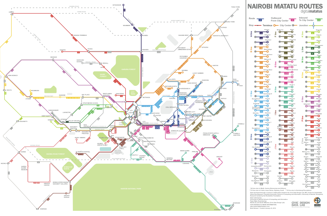
Researchers and students at the University of Nairobi, the Center for Sustainable Urban Development at Columbia University, and the Civic Data Design Lab at MIT produced the map below – and the underlying data behind it – after carrying cell phones and GPS devices along every route in the network. Result? There is order to Nairobi’s seemingly chaotic matatu industry.
Pretty cool stuff.
H/T Amanda R.
